
How Do GPS Breakdown Beacons Work? V16 Guide 2026
Table of Contents
- What Is a GPS Breakdown Beacon and How Does It Work?
- V16 Emergency Beacon Requirements: What Drivers Need to Know
- How to Use a Roadside Emergency Beacon: Step-by-Step
- Emergency Beacon Battery Life and Maintenance
- How GPS and Geospatial Coordinates Reach Emergency Services
- Privacy and Data Security: What Happens to Your Location Data
- Comparison of Connectivity Types
- Conclusion
- Frequently Asked Questions
Last Updated: September 10, 2026
What Is a GPS Breakdown Beacon and How Does It Work?
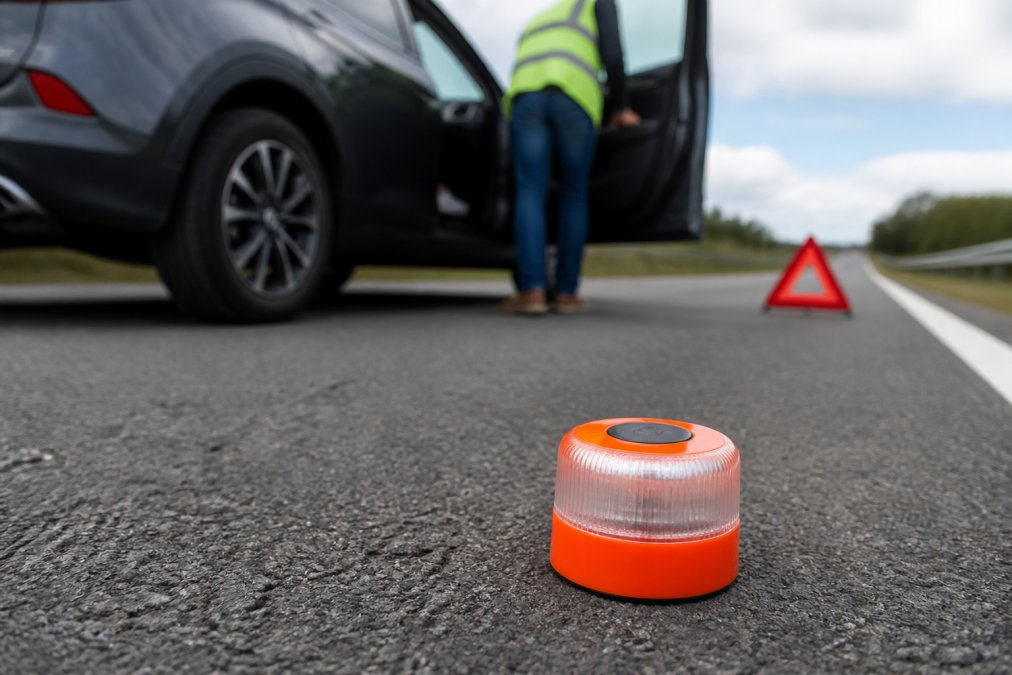
GPS breakdown beacons are portable warning devices combining a high-visibility flashing light with satellite positioning and mobile data transmission. When a vehicle breaks down, it warns approaching traffic and tells a traffic management system exactly where the stranded vehicle is.
The concept behind gps breakdown beacons is straightforward. A warning triangle is passive, relying on a driver’s eyesight. A connected beacon is active: it broadcasts a distress signal that a server receives, maps to geospatial coordinates, and passes to road safety organisations.
This guide explains the technology layer by layer, covering how the components fit together, what the V16 emergency beacon requirements demand, and what happens to your location data.
The Core Components Inside the Device
Every connected beacon is built around a small set of parts working in sequence.
- GNSS receiver: picks up signals from satellite constellations to calculate position
- SIM module: sends that position over a mobile network
- Control board: manages power, timing, and data packets
- Light array: produces the 360-degree amber flash
- Battery and charging circuit: typically USB-C or a 12V socket
The satellite receiver is the part most people underestimate. A standalone satnav can take a minute to lock on, but a well-designed beacon caches its last known position, so a disoriented driver can still transmit an approximate location immediately.
V16 Emergency Beacon Requirements: What Drivers Need to Know
The V16 emergency beacon requirements centre on one rule: a connected beacon must transmit its position to an authorised traffic management system, not simply flash. A device that only lights up does not meet the connected standard, no matter how bright it is.
The V16 specification is a Spanish standard (UNE 40721) that has become the European reference point because Spain mandated the connected version for all vehicles from 1 January 2026. Older non-connected V16 beacons are being phased out, and many cheap beacons sold online are the old passive type dressed up with a USB port.
A compliant connected beacon has to satisfy several technical conditions at once:
- Geolocation: the device must determine its own position via GNSS, not rely on the driver’s phone
- Connectivity: it must reach a traffic management platform over a mobile network without pairing to a handset
- Registered identity: each unit carries a unique identifier so the platform can validate the report
- Autonomous power: it must operate for a defined period on its own battery, independent of the vehicle
- Visibility: the light array must meet the specified flash frequency, colour, and 360-degree coverage
A compliant beacon is therefore a connected device, not a light: it needs an active data connection at activation, a registered identity, and a power source that will not fail after months in a glovebox.
A common mistake is buying a beacon, pairing it once, and never checking it again. If the SIM subscription lapses or the battery has gone flat, the device will still flash but will transmit nothing. You will not know until the moment you need it.
Because rules differ between countries and are still evolving, drivers should confirm current obligations with the relevant national transport authority and the retailer. Buyers should look for compliance documentation alongside each product to see which standard a unit is certified against.
How to Use a Roadside Emergency Beacon: Step-by-Step
Using a roadside emergency beacon takes under a minute if you have practised once. Here is the sequence recommended.
Total time: under 1 minute
Difficulty: beginner
What You’ll Need
- A charged, paired beacon
- Your vehicle’s registration details if prompted
- A safe position away from live traffic
Step 1: Stop Safely [Time: as long as it takes]
Pull as far onto the hard shoulder or verge as conditions allow. Switch on your hazard lights before leaving the vehicle.
Expected result: the vehicle is stationary, visible, and clear of the running lane.
Step 2: Exit on the Safe Side [Time: 10 seconds]
Leave through the door facing away from traffic. Keep passengers, especially children, behind the barrier if one exists.
Step 3: Activate the Beacon [Time: 5 seconds]
Press and hold the power button until the amber light begins its flash cycle. Most devices confirm activation with a short vibration or a change in flash pattern.
Step 4: Place It Correctly [Time: 10 seconds]
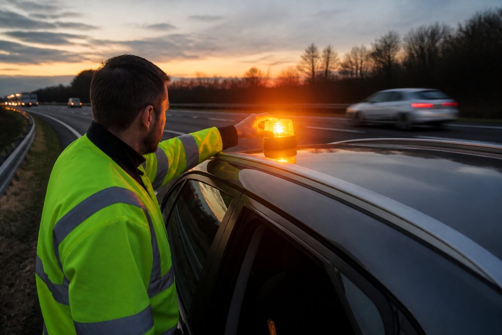
Mount the beacon on the roof or the highest practical point of the vehicle. Height makes the 360-degree amber light effective; a beacon on the ground is far harder to see over a crest or around a bend.
Expected result: the beacon is flashing, positioned high, and transmitting.
Step 5: Move to Safety
Wait behind the barrier, not beside the car. Emergency services will use the transmitted coordinates to find you.
Practise the activation sequence once in daylight, in a car park, before you ever need it. Muscle memory matters when you are standing on a live carriageway in the dark.
Activation and Placement
Placement is where most drivers get it wrong. The instinct is to put the beacon on the road behind the car, mirroring a triangle, but that is wrong for a connected device. The roof position maximises visibility distance and keeps the unit out of the path of passing vehicles.
Once active, the device sends geospatial coordinates at a fixed interval, often every few seconds, frequent enough to track a moving hazard, infrequent enough to preserve battery.
Emergency Beacon Battery Life and Maintenance
Emergency beacon battery life depends almost entirely on standby design, not on how long the light runs. A beacon that sits unused for a year and then dies in ten minutes has failed at the only job that matters.
Three maintenance habits keep a beacon reliable:
- Charge quarterly. Even devices with low self-discharge benefit from a top-up every three months.
- Check the SIM status. Confirm the data plan is active through the accompanying app or the supplier’s portal.
- Test the flash. A quick activation in a safe location confirms the light array and the battery are both healthy.
Lithium cells degrade fastest when stored fully discharged or in extreme heat, so a glovebox in direct summer sun is one of the worst places to keep a beacon. Store it in the cabin, out of direct sunlight, and it will hold its capacity far longer.
Treat the beacon like a smoke alarm: test it on a schedule, not when you need it. A quarterly two-minute check is the difference between a working device and an expensive ornament.
How GPS and Geospatial Coordinates Reach Emergency Services
Geospatial coordinates travel from the beacon to the responder through a chain of systems, which explains why some beacons are faster than others.
The device locks onto satellites, calculates latitude and longitude, and packages that position with a device identifier. It transmits the packet over a cellular network to the operator’s server, which validates the device, timestamps the position, and pushes it into a traffic management system. From there the data can reach emergency services and, in some implementations, navigation apps so approaching drivers receive a hazard warning.
This is the same layered approach used in maritime and aviation distress systems. Satellite networks such as Cospas-Sarsat, which operate on 406MHz and 121.5MHz, have carried emergency distress signals for decades, and the principles of position reporting, unique identification, and server-side integration carry directly into road safety. The Cospas-Sarsat international satellite system overview explains how that global search and rescue architecture works.
The practical difference between a good beacon and a poor one usually comes down to connectivity. A device that relies solely on one mobile network can fail in a coverage blackspot. Devices that support multiple networks, or that fall back to a secondary channel, are meaningfully more reliable on remote stretches of motorway.
Privacy and Data Security: What Happens to Your Location Data
Location data from a breakdown beacon is sensitive, and what happens to it depends on the operator. A well-run system collects only what it needs, retains it only as long as necessary, and shares it only with the parties who need it to respond.
Under data protection law, a device that transmits your position is processing personal data. That brings obligations around lawful basis, retention, and transparency. The Information Commissioner’s Office guidance on personal data sets out what organisations must tell individuals about how their data is used and how long it is kept.
Ask three questions before buying any connected beacon:
- What is transmitted? Position and device ID only, or more?
- Who receives it? Just the traffic authority, or third parties as well?
- How long is it stored? Minutes, or indefinitely?
A supplier that cannot answer those questions clearly is a supplier to avoid. Roadflash designs its beacons so that the data transmitted is limited to what a response actually requires: a position, an identifier, and a timestamp.
Comparison of Connectivity Types
Not all connected beacons reach the network the same way, and the choice affects reliability in exactly the situations where you need it most. The table below summarises the main options; the notes explain the trade-offs it cannot capture.
| Connectivity Type | Coverage | Typical Latency | Best For |
|---|---|---|---|
| Single-network cellular | Urban and motorway | Low | Regular commuters |
| Multi-network cellular | Broad, with fallback | Low | Remote routes |
| Cellular plus satellite | Near-universal | Higher | Fleets and isolated areas |
| Bluetooth to phone only | Depends on phone | Variable | Casual, low-cost use |
Cellular beacons use the same mobile networks as your phone. In built-up areas and along most motorways, coverage is strong and the position report reaches the platform in seconds. The weakness is the coverage blackspot: a rural road with no signal is precisely where a breakdown is most dangerous and least observed. A multi-network unit carries more than one SIM or roams across operators, so if one network is absent the device tries another, the single biggest reliability upgrade you can buy.
Satellite beacons bypass terrestrial networks entirely, transmitting to a satellite constellation. They work where no mobile mast exists, which is why they are standard in maritime and remote-area use. The trade-offs are real: higher latency, costlier hardware, and a subscription data plan. For a driver who rarely leaves the motorway network, the extra cost is hard to justify; for a fleet in remote areas, it is often the only option that reliably reports.
Bluetooth-to-phone beacons are the cheapest and least reliable. The beacon has no SIM; it hands its position to a paired phone, which transmits it. If the phone is dead, out of signal, or left in the car while the driver waits behind the barrier, nothing is sent. They are fine as a warning light but no substitute for a device with its own connection.
What the connectivity choice means for your data
Connectivity type also determines who holds your location data and for how long. A cellular beacon routes your position through a mobile operator and then the beacon platform; a satellite beacon routes it through the satellite operator. Each hop is a party that may retain a record. Under data protection law, a device that transmits your position is processing personal data, which brings obligations around lawful basis, retention, and transparency. The Information Commissioner’s Office guidance on personal data sets out what organisations must tell individuals about how their data is used and how long it is kept.
Ask three questions before buying any connected beacon:
- What is transmitted? Position and device ID only, or more?
- Who receives it? Just the traffic authority, or third parties as well?
- How long is it stored? Minutes, or indefinitely?
A supplier that cannot answer those questions clearly is a supplier to avoid. Roadflash designs its beacons so that the data transmitted is limited to what a response actually requires: a position, an identifier, and a timestamp.
Testing the connection before you need it
Whichever type you choose, the connection is the part most likely to fail silently. A quarterly check should confirm three things: the device powers on and flashes, the SIM or data plan is still active, and the platform can still see the unit. Most suppliers provide an app or portal showing the last reported position and registration status; if the last report is months old, the connection has lapsed even if the light still works.
Connectivity is not a spec-sheet footnote. It decides whether your breakdown is reported in seconds or not at all, and it determines which organisations hold your location data. Choose the type that matches your actual routes, then test it on a schedule.
Conclusion
The weakest link in roadside safety has always been the gap between a breakdown happening and anyone knowing about it. A connected beacon closes that gap, turning a passive warning into an active distress signal with a precise location attached.
Roadflash builds multi-award-winning early warning systems for exactly this problem, including DGT 3.0 compliant emergency beacons with GPS and geolocation and high-visibility lighting. These systems increase hazard awareness, improve vehicle visibility at the side of the road, and protect drivers and passengers during a breakdown.
Add to basket
Frequently Asked Questions
How do GPS-enabled breakdown beacons communicate with emergency services?
When activated, the beacon uses its built-in GPS receiver to calculate geospatial coordinates. It then transmits these coordinates, along with a distress signal, over a mobile network to a traffic management system or directly to emergency services. Some models also use satellite networks for backup. The receiving system plots the exact location on a map, allowing responders to find the stranded vehicle quickly, even if the driver is disoriented or unable to speak.
What are the V16 emergency beacon requirements for drivers?
V16 emergency beacons must meet specific technical standards, including a 360-degree amber light visible from at least one kilometre, a magnetic base for roof mounting, and connectivity to traffic management systems. In Spain, they are mandatory for roadside breakdowns. In the UK, they are not yet a legal requirement. Always check local regulations before travelling.
How long does the battery last on a typical emergency beacon?
Emergency beacon battery life varies by model and usage. Most V16 beacons use rechargeable lithium-ion batteries that last for several hours of continuous flashing. Standby time can be months. Some devices include a battery indicator or send a low-battery alert. Regular charging and proper storage help ensure the beacon works when needed. Always check the manufacturer’s specifications for exact runtime.
Do I need a GPS beacon for my vehicle in the UK?
Currently, UK law does not mandate GPS breakdown beacons for private vehicles. However, they are used by motorists who want to improve roadside safety. Unlike traditional triangles, these beacons provide a 360-degree amber light and can transmit your location to emergency services, reducing the risk of high-speed collisions. If you frequently drive on motorways or in low-visibility conditions, a GPS beacon can be a valuable safety tool.