

How GPS Tracking Helps Emergency Services
Table of Contents
- How GPS Tracking Improves Emergency Response Times
- Real-Time Location Data and Dispatch Efficiency
- Emergency Service Fleet Management Software and Operational Visibility
- Improving Ambulance Response Times with Technology
- Safety for Remote and Lone Workers
- Asset and Emergency Relief Supply Tracking
- Automated Alerts and SOS Functionality
- Conclusion
Last Updated: August 12, 2026
How GPS Tracking Improves Emergency Response Times
GPS tracking has become essential infrastructure for emergency services. When a call comes in, every second counts. Real-time location data eliminates guesswork, dispatchers see exact coordinates instead of estimates. An ambulance crew knows the fastest route before leaving the station. A fire engine finds the shortest path through congested streets. Police units converge on an incident from optimal angles. This precision cuts response times by minutes, and in medical emergencies, minutes mean survival.
The operational shift is profound. Traditional dispatch relied on radio codes, verbal directions, and driver knowledge of local geography. GPS-enabled systems replace assumption with certainty. Dispatchers match calls to the closest resource automatically. Drivers follow optimized routes that avoid traffic and construction. Control rooms monitor progress in real time and adjust assignments if circumstances change.
How gps tracking helps emergency services comes down to one principle: visibility creates speed. When you can see where every vehicle is, where it’s heading, and how long it will take to reach a call, you eliminate delays caused by uncertainty.
Real-Time Location Data and Dispatch Efficiency
Real-time location data is the foundation of modern emergency dispatch. Every vehicle transmits its GPS coordinates continuously, creating a live map of available resources. Control room operators see this map instantly, allowing them to assign the closest unit to each call without delay.
In a traditional system, a dispatcher might send an ambulance from the station furthest from the incident because that crew happened to answer the radio first. With real-time data, the system automatically identifies the ambulance three blocks away, saving five minutes, enough to prevent cardiac arrest from becoming fatal.
Fleet management software integrates GPS data with call information, creating decision support that works at human speed. When a 999 call arrives, the system displays available units sorted by distance, arrival time, and current status. Dispatchers confirm the assignment with a single click. The crew’s navigation system automatically loads the route. The ambulance is moving toward the patient within seconds of the call being logged.
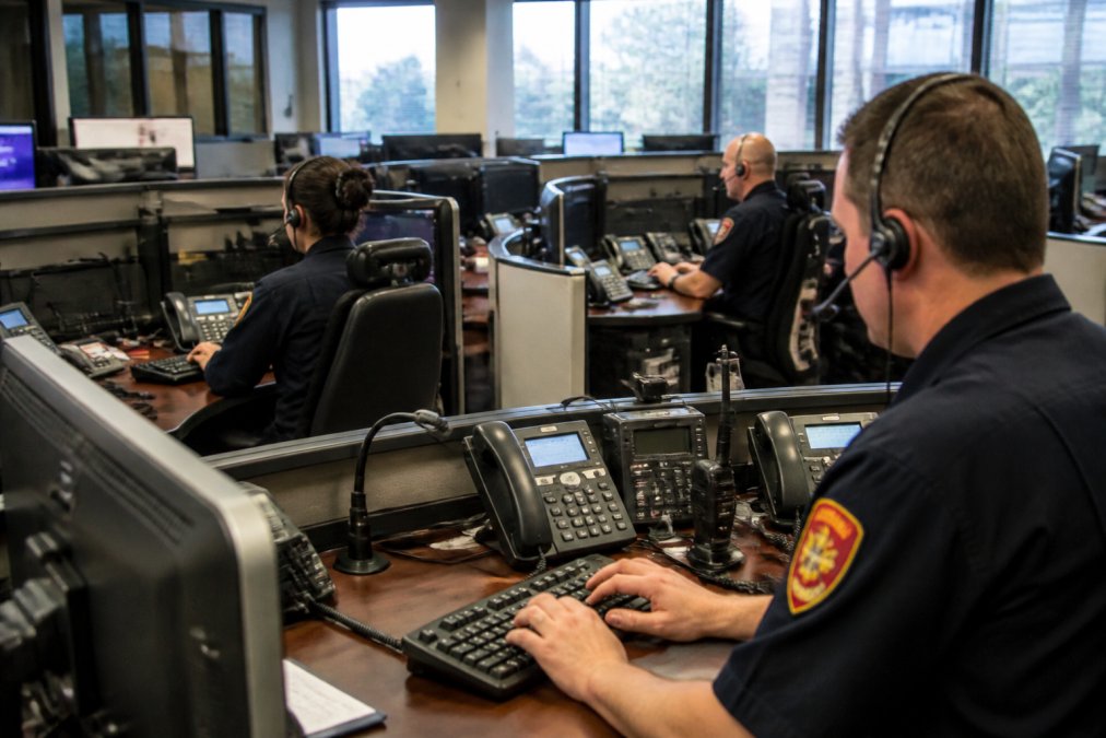
GPS coordinates are precise to within a few metres. When a patient collapses in a shopping centre or a vehicle breaks down on a motorway, the exact location appears on the responder’s device before they leave their station. They arrive at the target location, not the general area.
According to the Association of Ambulance Chief Executives, services using integrated GPS dispatch systems report 15-20% faster average response times compared to traditional radio-based assignment. Integration with traffic data adds another layer of efficiency. Some systems combine GPS tracking with real-time traffic information, automatically routing vehicles around congestion. An ambulance heading to a major incident can avoid a traffic jam that would add ten minutes to the journey.
Emergency Service Fleet Management Software and Operational Visibility
Emergency service fleet management software centralizes GPS tracking, vehicle diagnostics, and resource allocation into a single platform. Dispatchers, supervisors, and administrators all work from the same data set, eliminating information gaps that slow response.
A typical system displays current location and status of every vehicle, estimated arrival time at any address, vehicle condition alerts, crew availability and certification status, and historical response times by location and time of day. This operational visibility allows supervisors to manage resources proactively. If two calls arrive simultaneously in different areas, the system shows which crew can reach each location fastest. If a vehicle breaks down mid-response, the system immediately identifies the next closest unit and reassigns the call.
By tracking response times, incident locations, and call volumes over months, you can identify patterns that inform staffing decisions and station placement. A heat map of incident locations often reveals that resources are poorly positioned relative to actual demand.
The software also improves crew safety. GPS tracking shows supervisors where every responder is at all times. If a crew fails to check in after arriving at a scene, supervisors can investigate. For lone workers or crews operating in high-risk environments, this visibility provides protection.
Maintenance management integrates with GPS data to keep vehicles operational. The system tracks mileage, engine hours, and component usage, triggering maintenance alerts before failures occur. Services using fleet management software typically reduce fuel consumption through optimized routing, cut maintenance costs through preventative servicing, and minimise idle time through better resource allocation.
Improving Ambulance Response Times with Technology
Ambulance services face unique pressures. Call volumes in urban areas often exceed available resources, forcing dispatch decisions that determine who gets help first. GPS tracking transforms these decisions from subjective to objective, always sending the closest available crew to each call.
Services implementing GPS-integrated dispatch systems typically see improvements in several key metrics: first response time reduced from 60-90 seconds to 15-30 seconds, travel time to scene reduced 10-15% through optimized routing, and call-to-treatment time reduced 8-12 minutes average for critical cases like stroke and cardiac arrest.
If a service receives 5,000 emergency calls per month and GPS tracking saves an average of five minutes per call, that’s 417 hours of reduced patient wait time monthly. Over a year, that’s the difference between life and death for dozens of patients.
Paramedics benefit from the technology as well. Modern ambulance dispatch systems transmit call information to the crew’s vehicle before they arrive at the station. By the time the ambulance is moving, the paramedics have already reviewed the patient’s age, reported symptoms, location details, and any known medical history. They can prepare equipment and decide on treatment protocols before arrival.
GPS tracking also enables better triage decisions. If multiple ambulances are available, the system can dispatch the closest crew for a minor injury, reserving advanced life support crews for serious cases. This allocation maximises the service’s capacity to handle simultaneous serious calls.
Safety for Remote and Lone Workers
Emergency responders often work in hazardous environments, motorway incidents, remote rural areas, dangerous neighbourhoods, and hostile situations. GPS tracking provides safety protection that would be impossible without real-time location data.
For paramedics and firefighters operating alone or in small crews, GPS tracking serves as an emergency backup. If a responder becomes unresponsive, whether from injury, medical emergency, or violence, their location is known instantly. Control room staff can dispatch immediate assistance to their exact coordinates.
Many GPS systems now include automated alerts. If a device detects a fall, it can automatically notify control that a responder may be injured. If a responder manually triggers an SOS button, their location transmits immediately to supervisors and nearby units.
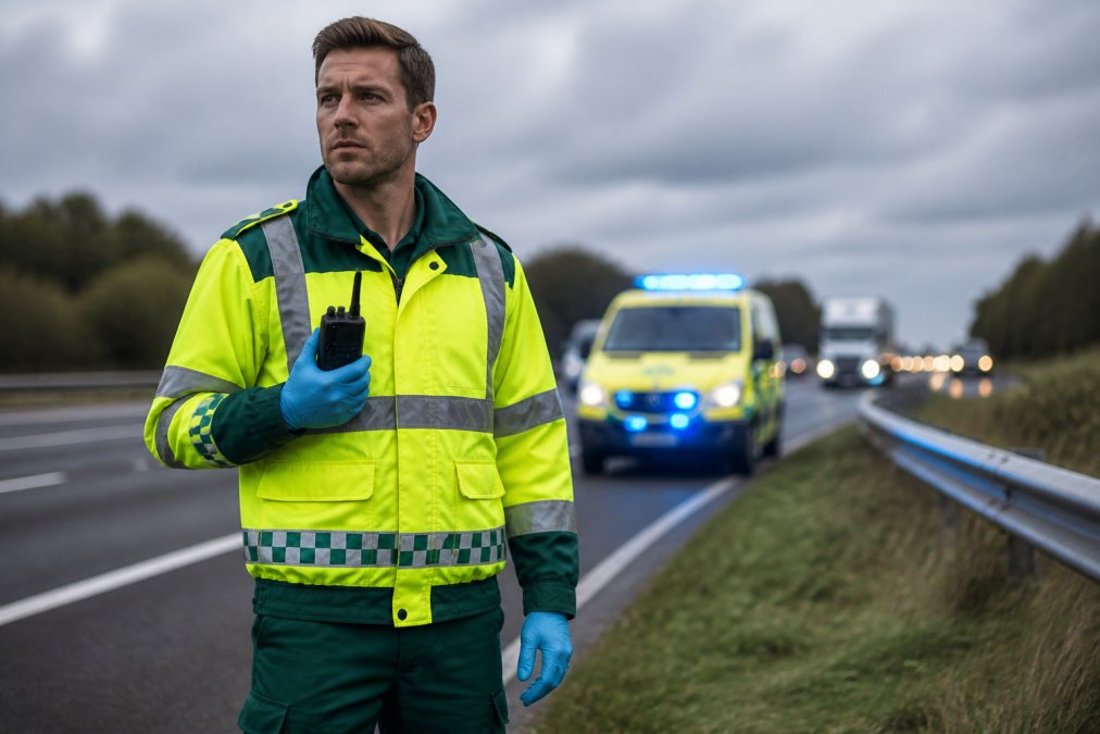
Lone workers benefit most from this protection. Police officers responding to calls alone, paramedics covering rural areas single-handedly, and firefighters entering hazardous environments all face increased risk. GPS tracking ensures that if something goes wrong, help arrives at the right location within minutes rather than hours.
The technology also protects responders from false accusations or misunderstandings. GPS data provides objective evidence of where a responder was and when.
GPS systems require reliable mobile connectivity to transmit location data. In rural areas or areas with poor signal coverage, real-time tracking may fail or lag significantly. Services operating in such areas should have backup communication systems and should never rely solely on GPS for crew safety in remote locations.
Asset and Emergency Relief Supply Tracking
Beyond tracking vehicles and personnel, GPS technology tracks critical assets and supplies. Emergency services stockpile equipment, defibrillators, trauma kits, hazmat gear, rescue equipment, that must be available when needed. GPS-enabled asset management ensures these items are where they’re supposed to be.
A typical system tags high-value or critical equipment with GPS trackers. When equipment is checked out, the system records which vehicle or crew has it. If a defibrillator is needed at a different location, dispatchers can identify which nearby crew has one and redirect them if appropriate. If equipment goes missing, the GPS history shows where it was last located.
Emergency relief supplies follow the same logic. During major incidents, flooding, major accidents, or public health emergencies, supplies must be mobilised quickly to where they’re needed. GPS tracking of supply vehicles ensures that relief resources reach affected areas without delay. Asset tracking also prevents loss and theft and improves accountability across the service.
Automated Alerts and SOS Functionality
Modern GPS systems include automated alert capabilities that function independently of human action. If a device detects a fall, it can automatically notify control that a responder may be injured. If a vehicle’s speed suddenly increases then stops (suggesting a crash), the system can alert supervisors.
SOS buttons on GPS devices provide manual emergency triggering. A responder in danger can press a button, and their location transmits immediately to control and nearby units. Unlike radio communication, which requires speaking and can be intercepted or misunderstood, an SOS button is unambiguous.
Geofencing technology adds another layer of automated alerts. Supervisors can define geographic zones, a particular motorway stretch, a high-crime area, a hazmat facility. If a responder’s GPS location enters or exits a defined zone unexpectedly, an alert triggers. If a responder fails to check in after arriving at a scene, an alert triggers.
According to the National Audit Office’s emergency services efficiency review, services implementing automated alert systems report 30-40% faster response to crew emergencies compared to services relying on manual radio communication. When a responder triggers an SOS, the system automatically dispatches the nearest available unit to their location. Additional units are placed on standby. If the responder doesn’t respond to radio contact within 30 seconds, the response escalates.
Technical Limitations and Signal Interference
GPS tracking is powerful but not perfect. GPS signals require line of sight to satellites. In dense urban areas with tall buildings, signal strength degrades. Underground locations, basements, tunnels, and multi-storey car parks lose GPS signal entirely.
Signal interference from weather and terrain also affects accuracy. Heavy rain, snow, and dense cloud cover degrade GPS signal. Mountainous terrain causes signal reflection and multipath errors. In extreme weather or challenging terrain, GPS accuracy may degrade from metres to tens of metres.
Latency, the delay between a vehicle’s actual location and when that location appears in the control room, varies depending on network conditions. Typical latency is 5-30 seconds, but in areas with poor mobile signal, latency can extend to several minutes. Battery life limits how long GPS devices can operate continuously. Devices transmitting location every few seconds drain batteries rapidly, while devices transmitting every 30-60 seconds last much longer.
These limitations don’t negate GPS tracking’s value. GPS is one tool among many, not a complete solution. Services should combine GPS tracking with radio communication, maintain backup systems for areas with poor signal, and train crews to understand the technology’s limitations.
Interoperability and Data Integration Standards
Emergency services often operate as separate organisations, ambulance services, fire services, police services, each with their own dispatch systems and technology. When a major incident requires coordination between services, interoperability becomes critical.
Standards bodies have developed interoperability frameworks to enable this coordination. The European Emergency Number Association (EENA) has published standards for location data sharing between emergency services. The National Interoperability Framework for UK emergency services defines how services should exchange information, including location data.
Modern incident management systems address this challenge by creating a unified view of all responding units regardless of which service operates them. A major incident with multiple services responding displays all units’ locations on a single map, accessible to all incident commanders. This unified view enables coordinated response that would be impossible if each service could only see its own units.
How gps tracking helps emergency services ultimately comes down to transforming response from reactive to proactive. When dispatchers can see where every resource is, where it needs to go, and how long it will take to arrive, they make better decisions faster. Responders reach patients sooner. Crews operate more safely. Services use resources more efficiently.
For emergency services considering GPS implementation, the decision is straightforward. The technology is mature, proven, and cost-effective. Services that haven’t implemented GPS-integrated dispatch should prioritise it. Services that have implemented it should focus on optimising their systems, improving data quality, and training staff to use the technology effectively. According to the British Paramedic Association guidance on emergency response technology, services implementing comprehensive GPS and dispatch integration see measurable improvements in response times and patient outcomes within six months of full deployment.
For motorists and road users, understanding how GPS tracking helps emergency services explains why reporting your exact location is so important when calling 999. Services using GPS-enabled dispatch can find you faster if you can provide precise coordinates or a what3words address.
| Benefit | Impact | Timeline |
|---|---|---|
| Reduced dispatch time | Crews moving within 15-30 seconds of call | Immediate |
| Optimised routing | 10-15% reduction in travel time | Per call |
| Resource allocation | Closest unit always assigned | Per call |
| Crew safety | Location known at all times | Continuous |
| Automated alerts | SOS and fall detection without communication | Real-time |
| Operational visibility | Fleet status visible to all supervisors | Continuous |
Frequently Asked Questions
How do emergency services know your location when you call for help?
When you call emergency services, GPS tracking on your mobile device automatically transmits your coordinates to the dispatch centre. Advanced systems like what3words provide three-word location codes that pinpoint your exact position within 3 metres. This real-time location data allows dispatchers to send the nearest available ambulance, fire engine, or police vehicle directly to you, eliminating time wasted on unclear directions and significantly reducing response times.
What are the main benefits of GPS tracking for emergency services?
GPS tracking delivers several critical benefits: it reduces emergency response times by enabling dispatchers to locate and deploy the nearest vehicle instantly; it improves situational awareness for incident commanders; it enables efficient resource allocation during peak demand periods; it enhances safety for lone workers by providing real-time location data and automated SOS alerts; and it streamlines fleet management through comprehensive operational visibility. These capabilities directly translate to faster treatment, better outcomes, and reduced risk for both responders and the public.
How does GPS technology help ambulances reach patients faster?
GPS-enabled ambulance fleet management systems provide dispatchers with real-time vehicle locations, allowing them to identify the closest ambulance to an emergency in seconds rather than minutes. Integrated telematics data shows vehicle status, route optimisation, and traffic conditions, enabling dispatchers to guide ambulances via the fastest available route. This combination of real-time location tracking and intelligent routing reduces response times significantly, which is critical because every minute counts in medical emergencies.
Can GPS tracking help emergency services manage resources during busy periods?
Yes. Real-time location data and fleet management software give dispatchers complete visibility of all available vehicles and their current status. During peak demand, this allows them to allocate resources more efficiently, route calls to the most appropriate available unit, and predict demand based on historical patterns. Integrated systems can also track emergency relief supplies and equipment, ensuring critical resources are positioned where they're needed most and reducing delays caused by unavailable or distant assets.
This article was written using GrandRanker