

How GPS Emergency Tracking Works: A 2026 Guide
Table of Contents
- How GPS Emergency Tracking Works: The Core Technology
- Step-by-Step: What Happens When You Trigger an SOS Alert
- Cellular vs Satellite Connectivity: Which Carries Your Location Data
- Emergency SOS Button Features: What to Look For in a Tracking Device
- How Emergency Services Locate Mobile Phones in the UK
- Choosing a Personal GPS Tracker in the UK: Types and Use Cases
- Technical Limitations of GPS Emergency Tracking and How to Work Around Them
- GPS Emergency Tracking on UK Roads: Beacons, Breakdowns and Visibility
Last Updated: August 2, 2026
Understanding how GPS emergency tracking works is one of the most practically important questions any driver, fleet manager, or safety-conscious commuter can ask. At Roadflash, we work directly with this technology through our GPS/Geolocation emergency beacons. The short answer: GPS emergency tracking combines satellite positioning, cellular or satellite data transmission, and emergency dispatch protocols to pinpoint your location and alert responders within seconds.
How GPS Emergency Tracking Works: The Core Technology
GPS emergency tracking determines a device’s precise geospatial coordinates using signals from orbiting satellites, then transmits those coordinates to emergency services via cellular or satellite networks.
The system relies on a global navigation satellite constellation. The original GPS constellation, operated by the US Space Force, consists of at least 24 operational satellites in medium Earth orbit. The EU’s Galileo system adds further coverage, and most modern tracking devices access multiple constellations simultaneously. According to European GNSS Agency (EUSPA) overview of GNSS constellations, multi-constellation receivers now deliver positioning accuracy well under five metres in open-sky conditions.
Triangulation and Geospatial Coordinates Explained
Triangulation is the mathematical process by which a GPS receiver calculates its position by measuring the time it takes for microwave signals to travel from at least three satellites to the device. Each satellite broadcasts a precise timestamp. The receiver compares that timestamp against its own clock, calculates the signal travel time, and converts that into a distance. Three distance measurements produce a point in three-dimensional space; a fourth satellite eliminates clock error and locks the fix.
The result is a geospatial coordinate pair: latitude and longitude, typically expressed to five or six decimal places. At six decimal places, one unit of longitude at UK latitudes resolves to roughly 0.07 metres, precise enough to locate a stranded driver on a motorway hard shoulder.
Satellite Constellation and Microwave Signal Transmission
GPS satellites transmit microwave signals at 1575.42 MHz (L1 band), with modern receivers also using L2 and L5 bands for improved accuracy and interference resistance. The satellite constellation is engineered so that at least four satellites are visible from any point on Earth at any time. A device in open countryside will typically see eight to twelve satellites simultaneously, enabling faster position fixes and better accuracy.
Step-by-Step: What Happens When You Trigger an SOS Alert
Triggering an SOS alarm initiates a sequence that moves faster than most people realise.
Step 1: Button activation. The user presses and holds the SOS button, typically for two to three seconds to prevent accidental triggers.
Step 2: Position fix. The device acquires or refreshes its GPS position. A cached fix takes under a second; a cold start can take fifteen to forty-five seconds.
Step 3: Data packet assembly. The device packages the geospatial coordinates, device ID, timestamp, battery status, and additional telemetry into a compact data packet.
Step 4: Transmission. The packet is transmitted via cellular or satellite to a monitoring platform or directly to emergency services infrastructure.
Step 5: Alert generation. The monitoring platform generates an instant alert, displaying the location on a mapping interface and notifying designated contacts or emergency dispatch.
Step 6: Emergency response. Emergency services receive the location data and dispatch the appropriate resource, feeding into the 999 and 112 call-handling infrastructure.
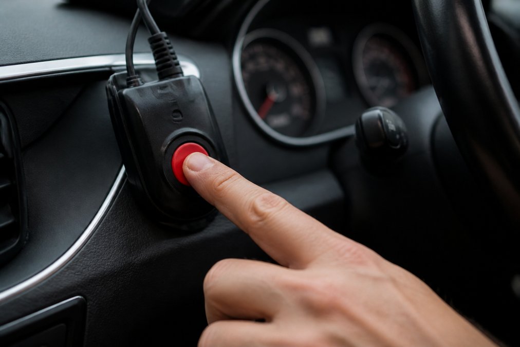
The entire sequence from button press to emergency dispatch confirmation can complete in under thirty seconds on a device with good cellular connectivity and a warm GPS fix.
A common mistake is assuming the SOS alert will always transmit instantly. In areas with poor cellular coverage, like remote motorway stretches or tunnels, a cellular-only device may fail to transmit. Always check whether your device has satellite fallback before relying on it for emergency use.
Cellular vs Satellite Connectivity: Which Carries Your Location Data
The connectivity question is the single most important technical decision in GPS emergency tracking.
Cellular connectivity uses mobile network infrastructure operated by providers like EE, Vodafone, and O2. It is fast, low-latency, and widely available on UK motorways and A-roads. The limitation is coverage gaps: rural areas, tunnels, and some Highland routes have no signal.
Satellite connectivity bypasses terrestrial networks entirely. Devices using Iridium, Globalstar, or Inmarsat networks can transmit from virtually anywhere on Earth. The trade-off is higher cost, larger device form factor, and slightly higher latency.
| Connectivity Type | Coverage | Latency | Best For |
|---|---|---|---|
| Cellular (4G/5G) | Urban and major roads | Very low (1-3 seconds) | Commuters on motorways and A-roads |
| Satellite (Iridium/Globalstar) | Global, including remote areas | Low-medium (5-20 seconds) | Rural drivers, offshore, expeditions |
| Dual-mode (cellular + satellite) | Near-universal | Very low with cellular fallback | Fleet operators, high-risk routes |
For most UK motorway drivers, cellular connectivity is sufficient. For anyone regularly travelling remote routes, dual-mode is the correct specification.
Emergency SOS Button Features: What to Look For in a Tracking Device
The critical specifications are:
- Accidental trigger protection: A recessed button or two-step confirmation prevents false alarms.
- Battery life under transmission load: A device must sustain operation during active tracking.
- Confirmation feedback: The device must clearly confirm that the alert has been sent.
- Geofencing capability: Advanced devices allow alerts to trigger automatically when a vehicle leaves a defined area.
- Fall detection integration: Accelerometer data combined with GPS positioning triggers an alert automatically after sudden impact, without requiring user action.
For motorway breakdowns specifically, prioritise devices that broadcast [high-visibility signals](/emergency-breakdown-lights-a-professional-comparison-for-uk-motorists-in-2026/) alongside the GPS alert. A beacon that makes your vehicle visible to approaching traffic at 70mph addresses the immediate physical danger while the GPS alert handles emergency response.
How Emergency Services Locate Mobile Phones in the UK
Emergency services in the UK can locate a caller’s mobile phone even without a dedicated GPS tracking device.
Advanced Mobile Location (AML) and Its Role in UK Emergency Response
Advanced Mobile Location automatically transmits a caller’s location to emergency services when they dial 999 or 112. According to BT’s documentation on Advanced Mobile Location in the UK, AML is activated automatically on compatible smartphones, sending a precise GPS or Wi-Fi-derived location to the emergency call handler without any action from the caller.
AML typically delivers accuracy within a few metres in urban areas, a significant improvement over older cell-tower triangulation methods. The limitation is that it depends on the caller making a voice call and the handset being functional. A driver who is unconscious, whose phone battery is dead, or whose phone has been damaged in a collision cannot trigger AML. A dedicated GPS emergency tracking device with an independent power source and automatic SOS capability addresses this failure mode.
Choosing a Personal GPS Tracker in the UK: Types and Use Cases
The personal GPS tracker UK market offers several distinct device categories, each suited to different risk profiles.
Wearable Trackers, Vehicle Beacons and GPS Fall Detection Devices in the UK
Wearable personal trackers are compact devices worn on the wrist or carried in a pocket, designed for lone workers, elderly users, and children. GPS fall detection devices in this category use accelerometers to detect sudden changes in movement consistent with a fall, then automatically transmit the user’s location. These are increasingly specified by UK employers under their duty of care obligations for lone workers, as referenced in guidance from Health and Safety Executive lone worker guidance.
Vehicle beacons with GPS/Geolocation serve a different function. Devices like those produced by Roadflash integrate GPS positioning with high-visibility warning systems. When a vehicle is stationary on a motorway hard shoulder, the beacon simultaneously alerts approaching traffic with intense visible light and broadcasts the vehicle’s precise location, enabling emergency services to locate and protect the scene rapidly.
For fleet operators managing fifteen or more vehicles, a vehicle beacon with integrated GPS offers both regulatory compliance benefits and operational visibility to track assets in real time.
Technical Limitations of GPS Emergency Tracking and How to Work Around Them
The technology works extremely well under the right conditions. The conditions are not always right.
Signal Interference, Latency and Location Accuracy Issues
GPS signal strength is measured in decibels relative to one milliwatt. The signals arriving from satellites are extraordinarily weak, making them vulnerable to interference. Sources relevant to UK drivers include:
- Urban canyons: Tall buildings reflect and block satellite signals, causing position errors of tens of metres.
- Tunnels and underpasses: GPS fix is lost entirely. A device should cache its last known position and resume tracking on exit.
- Electronic interference: Poorly shielded in-vehicle electronics can degrade GPS reception.
Latency depends on both the GPS fix rate and the transmission interval. A device with a one-second fix rate and a five-second transmission interval will always show a position up to six seconds old. For a vehicle travelling at 70mph, six seconds represents over 180 metres of travel.
For GPS emergency tracking to be reliable in practice, the device needs multi-constellation reception, a cellular-plus-satellite fallback, and a transmission interval of thirty seconds or less. Single-constellation, cellular-only devices with slow update rates are inadequate for genuine emergency response.
Privacy, Data Security and UK Regulatory Requirements
GPS location data is personal data under the UK General Data Protection Regulation. Any organisation collecting, storing, or processing location data must comply with the UK GDPR and the Data Protection Act 2018, enforced by the Information Commissioner’s Office.
The key requirements are:
- Lawful basis: Employers must establish a lawful basis for processing location data.
- Transparency: Drivers must be informed that tracking is in place, what data is collected, how long it is retained, and who has access to it.
- Data minimisation: Only location data necessary for the stated purpose should be collected.
- Security: Location data must be stored securely and access restricted to authorised personnel.
For personal GPS trackers used by individuals for their own safety, the user controls their own data. Regulatory complexity arises in employment and fleet contexts.
GPS Emergency Tracking on UK Roads: Beacons, Breakdowns and Visibility
The hard truth about breakdowns on UK motorways is that the GPS alert is only half the problem. Emergency services finding your location quickly is critical. Approaching vehicles seeing your stationary car before it is too late is equally critical, and it is the part that pure tracking technology cannot address.
Roadflash’s multi-award-winning emergency beacons integrate GPS/Geolocation positioning with high-intensity warning lights specifically designed to increase hazard awareness for vehicles approaching at motorway speeds. When a driver triggers an SOS, they simultaneously broadcast their digital location to emergency services and their physical presence to traffic. This is the gap that a phone-based AML system or a wearable tracker alone cannot fill.
For drivers who commute on motorways even a few times per week, the risk of a breakdown in a high-speed environment is real. A reflective triangle requires the driver to exit the vehicle and walk along a live carriageway. A beacon with integrated GPS removes that exposure entirely.
Fleet operators and road infrastructure maintenance teams have additional obligations under UK traffic management regulations. GPS-enabled beacons that log position and activation times provide an auditable record of compliance that standard warning triangles cannot.
For those operating in Spain, Roadflash beacons are DGT 3.0 compliant, meeting the specific certification requirements of Spain’s Directorate General of Traffic for GPS-enabled emergency warning devices.
The specification that matters most for UK roads is the combination of precise location transmission, reliable connectivity, and physical visibility working together.
Breakdowns on UK motorways leave drivers exposed to real danger, and neither hazard lights nor a reflective triangle fully addresses the risk of a high-speed approach. Roadflash’s GPS/Geolocation emergency beacons combine precise real-time location transmission with multi-award-winning high-visibility warning systems, protecting drivers during breakdowns by making them visible both digitally to emergency services and physically to approaching traffic. Add to basket and give every journey the protection it deserves.
Frequently Asked Questions
What is an SOS button on a GPS tracker and how does it work?
An SOS button on a GPS tracker sends an instant alert containing your geospatial coordinates to a designated contact, monitoring centre or emergency services. When pressed, the device transmits a data packet via cellular network or satellite, including your real-time location. Some devices also open a two-way voice channel. The speed of response depends on signal strength, tracking frequency and whether the device uses cellular or satellite connectivity.
How do emergency services use GPS to find you in the UK?
UK emergency services use a system called Advanced Mobile Location (AML), which automatically activates on compatible smartphones when you call 999. AML uses GPS, Wi-Fi positioning and cellular network data to calculate your location and transmits it directly to emergency dispatch. This gives call handlers far greater location accuracy than a standard mobile network cell-tower estimate, significantly reducing response times in situations where the caller cannot speak.
Do GPS emergency trackers work without mobile signal in the UK?
Standard personal GPS trackers that rely on cellular networks will not transmit location data in areas without mobile coverage. Satellite-based devices, however, communicate directly with a satellite constellation and can send SOS alerts from remote locations where there is no cellular signal. If you regularly travel through rural or highland areas of the UK, a satellite-capable tracking device offers considerably more reliable connectivity than a cellular-only model.
How accurate is GPS tracking for emergency situations?
Under open-sky conditions, modern GPS emergency tracking can achieve location accuracy within a few metres. Accuracy reduces in urban canyons, tunnels or dense woodland where satellite signals are obstructed. Devices that combine GPS triangulation with cellular network positioning or Wi-Fi data generally maintain better precision in built-up areas. For roadside emergencies, a GPS beacon that transmits precise geospatial coordinates can help emergency services reach you faster than hazard lights alone.
Are GPS emergency beacons on UK roads subject to any regulations?
In the UK, roadside emergency equipment is governed by guidance from the Driver and Vehicle Licensing Agency (DVLA) and the Highway Code. Devices that transmit location data are subject to UK GDPR under the Data Protection Act 2018, which governs how location data is stored and shared. If you drive in Spain, emergency beacons must meet DGT 3.0 compliance standards, which include GPS and geolocation functionality as a legal requirement for vehicles on Spanish roads.
This article was written using GrandRanker